Kilimanjaro Trek Routes
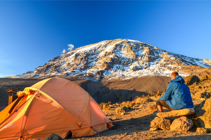
Mount Kilimanjaro with its three volcanic cones, "Kibo", "Mawenzi", and "Shira", is a dormant volcanic mountain in Tanzania. It is the highest mountain in Africa, and rises approximately 4,877 metres (16,001 ft) from its base to 5,895 metres (19,341 ft) above sea level. The first recorded ascent to the summit of the mountain was by Hans Meyer and Ludwig Purtscheller in 1889. The mountain is part of the Kilimanjaro National Park and is a major climbing destination. The mountain has been the subject of many scientific studies because of its shrinking glaciers.
Geology and Physical Features::
Kilimanjaro rises approximately 4,877 metres (16,001 ft) from its southern base in the plains near the municipality of Moshi to its summit height of 5,895 metres (19,341 ft). Kilimanjaro is a large stratovolcano and is composed of three distinct volcanic cones: Kibo, the highest; Mawenzi at 5,149 metres (16,893 ft); and Shira, the shortest at 4,005 metres (13,140 ft). Mawenzi and Shira are extinct, while Kibo is dormant and could erupt again.
Uhuru Peak is the highest summit on Kibo's crater rim. The Tanzania National Parks Authority, a governmental agency, and the United Nations Educational, Scientific and Cultural Organization list the height of Uhuru Peak as 5,895 m (19,341 ft). That height is based on a British Ordnance Survey in 1952. Since then, the height has been measured as 5,892 metres (19,331 ft) in 1999, 5,891 metres (19,327 ft) in 2008, and 5,888 metres (19,318 ft) in 2014.
Trekking Kilimanjaro::
Kilimanjaro National Park generated US $51 million in revenue in 2013,:285 the second-most of any Tanzanian national park.[45]:258 (The Ngorongoro Conservation Area, which includes the heavily visited Ngorongoro Crater, is not a national park.) The fees for park usage and for climbing Kilimanjaro during the 2015/16 budget year are published on the Internet. The Tanzania National Parks Authority reported that the park recorded 57,456 tourists during the 2011-12 budget year, of whom 16,425 hiked the mountain, which was well below the capacity of 28,470 as specified in the park's General Management Plan. The mountain climbers generated irregular and seasonal jobs for about 11,000 guides, porters, and cooks in 2007, although serious concerns have been raised about their poor working conditions and inadequate wages. :287–291:259
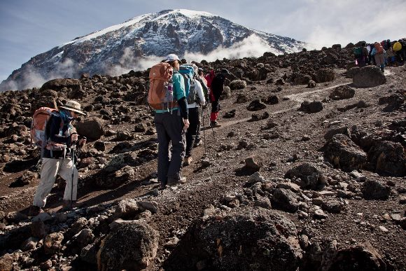
There are seven official trekking routes by which to ascend and descend Mount Kilimanjaro: Lemosho, Machame, Marangu, Mweka, Rongai, Shira, and Umbwe. Of all the routes, Machame is considered the most scenic, albeit steeper, route. It can be done in six or seven days. The Rongai is the easiest and least scenic of all camping routes. The Marangu is also relatively easy, but this route tends to be very busy, the ascent and descent routes are the same, and accommodation is in shared huts with all other climbers.People who wish to trek to the summit of Kilimanjaro are advised to undertake appropriate research and ensure that they are both properly equipped and physically capable. Though the climb is technically not as challenging as when climbing the high peaks of the Himalayas or Andes, the high elevation, low temperature, and occasional high winds make this a difficult and dangerous trek. Acclimatisation is essential, and even the most experienced trekkers suffer some degree of altitude sickness.
MARANGU ROUTES
The Marangu route, also 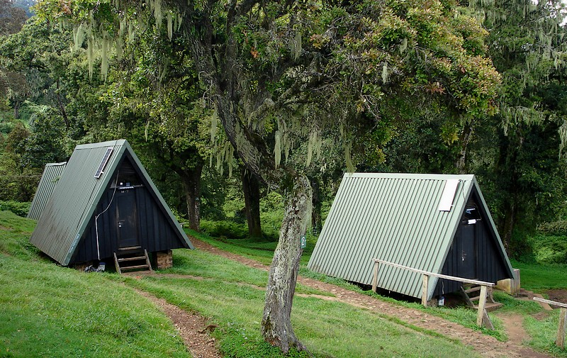 known as the "Coca-Cola" route, is the oldest, most well established route on Kilimanjaro. This is the only route which offers sleeping huts in dormitory style accommodations in lieu of camping. There are 60 bunk beds each at Mandara and Kibo Huts, and 120 bunk beds at Horombo Hut. Guests are supplied with mattresses and pillows, but sleeping bags are still required. The huts have communal dining halls and basic washrooms, ranging from flushing toilets and running water at the lower huts to long drop toilets and buckets of water at Kibo Hut.
Many favor Marangu because it is considered to be the easiest path on the mountain, given its gradual slope and direct path. However the short time frame of the route makes altitude acclimatization fairly difficult. The route approaches Mount Kilimanjaro from the southeast. Marangu is unfortunately less scenic than the other routes because the ascent and descent are along the same path. It is also the most crowded route for that reason.
Stepclimb Adventures offers Marangu as five or six day private climb. The five day variation does not have an acclimatization day on day three at Horombo Hut.
MARANGU ITINERARY DAY 1 DAY 2 DAY 3 DAY 4 DAY 5 Uhuru Peak to Horombo Hut After spending a few moments taking in the plains of Africa and your accomplishment, we descend to Horombo Hut. Later in the evening, we enjoy our last dinner on the mountain and a well-earned sleep. DAY 6 |
MACHAME ROUTES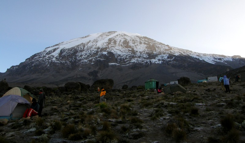
The Machame route, also known as the "Whiskey" route, is the most popular route on Kilimanjaro. Machame’s draw is in its scenic beauty. However, the trail is considered difficult, steep and challenging, particularly due to its shorter itinerary. Therefore this route is better suited for more adventurous folks or those with some high altitude, hiking or backpacking experience.
The route approaches Mount Kilimanjaro from the south, beginning with a short drive from Moshi to Machame Gate. The path leads hikers through the rain forest to Shira Plateau. Here, many of Kilimanjaro’s routes converge. Then the route turns east and traverses underneath Kilimanjaro's Southern Ice Field on a path known as the Southern Circuit before summiting from Barafu. Descent is made via the Mweka route.
Stepclimb Adventures offers Machame as a seven day group climb or as a six day private climb. The six day variation combines days four and five, going from Barranco Camp to Barafu Camp without staying at Karanga.
DAY MACHAME ITINERARY
DAY 1
Machame Gate to Machame Camp
Elevation: 5,380 ft to 9,350 ft
Distance: 11 km/7 miles
Hiking Time: 5-7 hours
Habitat: Rain Forest
The drive from Moshi to the Machame Gate takes about 50 minutes. The journey passes through the village of Machame which is located on the lower slopes of the mountain. As we leave the park gate, we walk through the dense rain forest on a winding trail up a ridge until we reach the Machame Camp.
DAY 2
Machame Camp to Shira 2 Camp
Elevation: 9,350 ft to 12,500 ft
Distance: 5 km/3 miles
Hiking Time: 4-6 hours
Habitat: Heath
We leave the glades of the rain forest and continue on an ascending path up to a steep, rocky ridge. On the Shira Plateau, we pass through heather and open moorlands, then cross a large river gorge to Shira 2 Camp.
DAY 3
Shira 2 Camp to Lava Tower
Elevation: 12,500 ft to 15,190 ft
Distance: 7 km/4 miles
Hiking Time: 4-5 hours
Habitat: Alpine Desert
Lava Tower to Barranco Camp
Elevation: 15,190 ft to 13,044 ft
Distance: 3 km/2 miles
Hiking Time: 2-3 hours
Habitat: Alpine Desert
We continue to the east up a ridge and then head southeast towards the Lava Tower – a 300 ft tall volcanic rock formation. We descend down to Barranco Camp through the strange but beautiful Senecio Forest to an altitude of 13,000 ft. Although you begin and end the day at the same elevation, the time spent at higher altitude is very beneficial for acclimatization.
DAY 4
Barranco Camp to Karanga Camp
Elevation: 13,044 ft to 13,106 ft
Distance: 5 km/3 miles
Hiking Time: 4-5 hours
Habitat: Alpine Desert
We begin the day by descending into a ravine to the base of the Great Barranco Wall. Then we climb the non-technical but steep, nearly 900 ft cliff. From the top of the Barranco Wall we cross a series of hills and valleys until we descend sharply into Karanga Valley. One more steep climb up leads us to Karanga Camp. This is a shorter day meant for acclimatization.
DAY 5
Karanga Camp to Barafu Camp
Elevation: 13,106 ft to 15,331 ft
Distance: 4 km/2 miles
Hiking Time: 4-5 hours
Habitat: Alpine Desert
We leave Karanga and hit the junction which connects with the Mweka Trail. We continue up to the rocky section to Barafu Hut. At this point, you have completed the Southern Circuit, which offers views of the summit from many different angles. Here we make camp, rest and enjoy an early dinner to prepare for the summit day. The two peaks of Mawenzi and Kibo are viewable from this position.
DAY 6
Barafu Camp to Uhuru Peak
Elevation: 15,331 ft to 19,341 ft
Distance: 5 km/3 miles
Hiking Time: 7-8 hours
Habitat: Arctic
Uhuru Peak to Mweka Camp
Elevation: 19,341 ft to 10,065 ft
Distance: 12 km/7 miles
Hiking Time: 4-6 hours
Habitat: Rain Forest
Very early in the morning (around midnight), we begin our push to the summit. This is the most mentally and physically challenging portion of the trek. The wind and cold at this elevation and time of day can be extreme. We ascend in the darkness for several hours while taking frequent, but short, breaks. Near Stella Point (18,900 ft), you will be rewarded with the most magnificent sunrise you are ever likely to see coming over Mawenzi Peak. Finally, we arrive at Uhuru Peak- the highest point on Mount Kilimanjaro and the continent of Africa.
From the summit, we now make our descent continuing straight down to the Mweka Hut camp site, stopping at Barafu for lunch. The trail is very rocky and can be quite hard on the knees; trekking poles are helpful. Mweka Camp is situated in the upper forest and mist or rain can be expected in the late afternoon. Later in the evening, we enjoy our last dinner on the mountain and a well-earned sleep.
DAY 7
Mweka Camp to Mweka Gate
Elevation: 10,065 ft to 5,380 ft
Distance: 10 km/6 miles
Hiking Time: 3-4 hours
Habitat: Rain Forest
On our last day, we continue the descent to Mweka Gate and collect the summit certificates. At lower elevations, it can be wet and muddy. From the gate, we continue another hour to Mweka Village. A vehicle will meet us at Mweka Village to drive us back to the hotel in Moshi.
LEMOSHO ROUTES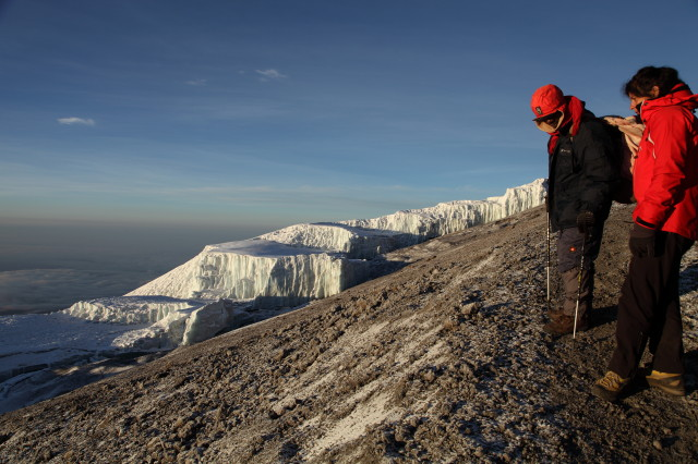
The Lemosho route is considered the most scenic trail on Kilimanjaro, granting panoramic vistas on various sides of the mountain. As one of the newer routes, Lemosho is a superb choice for your climb. It is our preferred route due to its ideal balance of low crowds, beautiful scenery and a high summit success rate. Ultimate Kilimanjaro® specializes in guiding on the Lemosho route. Most of our clients climb Kilimanjaro using this route and they consistently report that they loved it. Thus, Lemosho is highly recommended.
The route approaches Mount Kilimanjaro from the west, beginning with a long drive from Moshi to Londorossi Gate. From there, the first two days are spent trekking through the rain forest to Shira Ridge. The Lemosho route crosses the entire Shira Plateau from west to east in a pleasant, relatively flat hike. Crowds are low until the route joins the Machame route near Lava Tower. Then the route traverses underneath Kilimanjaro's Southern Ice Field on a path known as the Southern Circuit before summiting from Barafu. Descent is made via the Mweka route.
Stepclimb Adventures offers Lemosho as an eight day group climb or as a seven to eight day private climb. The seven day variation combines days five and six, going from Barranco Camp to Barafu Camp without staying at Karanga. A nine day variation that includes an overnight at Crater Camp is available as a private climb by spec
DAY LEMOSHO ITINERARY
Day 1
Londorossi Gate to Mti Mkubwa
Elevation: 7,742 ft to 9,498 ft
Distance: 6 km/4 miles
Hiking Time: 3-4 hours
Habitat: Rain Forest
We depart Moshi for Londorossi Gate, which takes about 4 hours, where you will complete entry formalities. Then drive to the Lemosho trailhead. Upon arrival at trailhead, we begin hiking through undisturbed forest which winds to the first camp site.
DAY 2
Mti Mkubwa to Shira 1 Camp
Elevation: 9,498 ft to 11,500 ft
Distance: 8 km/ 5miles
Hiking Time 5-6 hours
Habitat: Health
We continue on the trail leading out of the rain forest and into a savannah of tall grasses, heather and volcanic rock draped with lichen beards. As we ascend through the lush rolling hills and cross several streams, we reach the Shira Ridge before dropping gently down to Shira 1 Camp. Here we catch our first glimpse of Kibo across the plateau.
DAY 3
Shira 1 Camp to Moir Hut
Elevation: 11,500 ft to 13,800 ft
Distance: 11 km/ 7 miles
Hiking Time: 5-7 hours
Habitat: Heath
We explore the Shira Plateau for a full day. It is a gentle walk east on moorland meadows towards Shira 2 Camp. Then we divert from the main trail to Moir Hut, a little used site on the base of Lent Hills. A variety of walks are available on Lent Hills making this an excellent acclimatization opportunity. Shira Plateau is one of the highest plateaus on earth.
DAY 4
Moir Hut to Lava Tower
Elevation: 13,800 ft to 15,190 ft
Distance: 7 km/4 miles
Hiking Time: 4-5 hours
Habitat: Alpine Desert
Lava Tower to Barranco Camp
Elevation: 15,190 ft to 13,044 ft
Distance: 3 km/2 miles
Hiking Time: 2-3 hours
Habitat: Alpine Desert
We begin the day climbing up a ridge and then head southeast towards the Lava Tower – a 300 ft tall volcanic rock formation. We descend down to Barranco Camp through the strange but beautiful Senecio Forest to an altitude of 13,000 ft. Although you begin and end the day at the same elevation, the time spent at higher altitude is very beneficial for acclimatization.
DAY 5
Barranco Camp to Karanga Camp
Elevation: 13,044 ft to 13,106 ft
Distance: 5 km/3 miles
Hiking Time: 4-5 hours
Habitat: Alpine Desert
We begin the day by descending into a ravine to the base of the Great Barranco Wall. Then we climb the non-technical but steep, nearly 900 ft cliff. From the top of the Barranco Wall we cross a series of hills and valleys until we descend sharply into Karanga Valley. One more steep climb up leads us to Karanga Camp. This is a shorter day meant for acclimatization.
DAY 6
Karanga Camp to Barafu Camp
Elevation: 13,106 ft to 15,331 ft
Distance: 4 km/2 miles
Hiking Time: 4-5 hours
Habitat: Alpine Desert
We leave Karanga and hit the junction which connects with the Mweka Trail. We continue up to the rocky section to Barafu Hut. At this point, you have completed the Southern Circuit, which offers views of the summit from many different angles. Here we make camp, rest and enjoy an early dinner to prepare for the summit day. The two peaks of Mawenzi and Kibo are viewable from this position.
DAY 7
Barafu Camp to Uhuru Peak
Elevation: 15,331 ft to 19,341 ft
Distance: 5 km/3 miles
Hiking Time: 7-8 hours
Habitat: Arctic
Uhuru Peak to Mweka Camp
Elevation: 19,341 ft to 10,065 ft
Distance: 12 km/7 miles
Hiking Time: 4-6 hours
Habitat: Rain Forest
Very early in the morning (around midnight), we begin our push to the summit. This is the most mentally and physically challenging portion of the trek. The wind and cold at this elevation and time of day can be extreme. We ascend in the darkness for several hours while taking frequent, but short, breaks. Near Stella Point (18,900 ft), you will be rewarded with the most magnificent sunrise you are ever likely to see coming over Mawenzi Peak. Finally, we arrive at Uhuru Peak- the highest point on Mount Kilimanjaro and the continent of Africa.
From the summit, we now make our descent continuing straight down to the Mweka Hut camp site, stopping at Barafu for lunch. The trail is very rocky and can be quite hard on the knees; trekking poles are helpful. Mweka Camp is situated in the upper forest and mist or rain can be expected in the late afternoon. Later in the evening, we enjoy our last dinner on the mountain and a well-earned sleep.
DAY 8
Mweka Camp to Mweka Gate
Elevation: 10,065 ft to 5,380 ft
Distance: 10 km/6 miles
Hiking Time: 3-4 hours
Habitat: Rain Forest
On our last day, we continue the descent to Mweka Gate and collect the summit certificates. At lower elevations, it can be wet and muddy. From the gate, we continue another hour to Mweka Village. A vehicle will meet us at Mweka Village to drive us back to the hotel in Moshi.
SHIRA ROUTES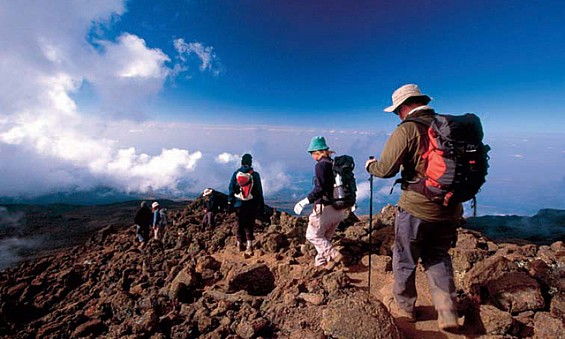
The Shira Route is a little used trail that begins near Shira Ridge. It is nearly identical to the Lemosho route. In fact, Shira was the original route and Lemosho is the improved variation. Although Shira is a varied and beautiful route, it is less favorable than its successor due to the relatively high altitude of Shira's starting point, which is accessed quickly by vehicle. It is possible that climbers will experience some altitude related symptoms on the first day while camping at 11,800 feet.
The route approaches Mount Kilimanjaro from the west, beginning with a long drive from Moshi to Shira Ridge. The vehicle bypasses the rain forest zone and the hiking trail begins on Shira Ridge. The Shira route crosses the entire Shira Plateau from west to east in a pleasant, relatively flat hike. Then the route traverses underneath Kilimanjaro's Southern Ice Field on a path known as the Southern Circuit before summiting from Barafu. Descent is made via the Mweka route.
Stepclimb Adventures offers Shira as a seven or eight day private climb. The eight day variation adds a stay at Moir Hut on day three before going to Barranco Camp on day four.
DAY SHIRA ITINERARY
Day 1
Shira Gate to Simba Camp
Elevation: 11,800 ft to 11,800 ft
Distance: 4 km/2 miles
Hiking Time: 1-2 hours
Habitat: Heath
We depart Moshi for Londorossi Gate, which takes about 4 hours; here we will complete entry formalities while guides and porters prepare equipment. We then continue to drive up a steep path to the Shira Gate where we will begin the hike. The trek starts through shrubs and giant heather until we reach Simba Camp.
Day 2
Simba Camp to Shira 2 Camp
Elevation: 11,800 ft to 12,500 ft
Distance: 6 km/4 miles
Hiking Time: 2 hours
Habitat: Heath
Today is a fairly easy day to help with acclimatization. We begin by exploring the grassy moorland and volcanic rock formations on the plateau. Then we take a scenic path to the Shira Cathedral, a huge buttress of rock surrounded by steep spires and pinnacles, before settling at Shira 2 Camp.
DAY 3
Shira 2 Camp to Lava Tower
Elevation: 12,500 ft to 15,190 ft
Distance: 7 km/4 miles
Hiking Time: 4-5 hours
Habitat: Alpine Desert
Lava Tower to Barranco Camp
Elevation: 15,190 ft to 13,044 ft
Distance: 3 km/2 miles
Hiking Time: 2-3 hours
Habitat: Alpine Desert
We continue to the east up a ridge and then head southeast towards the Lava Tower – a 300 ft tall volcanic rock formation. We descend down to Barranco Camp through the strange but beautiful Senecio Forest to an altitude of 13,000 ft. Although you begin and end the day at the same elevation, the time spent at higher altitude is very beneficial for acclimatization.
DAY 4
Barranco Camp to Karanga Camp
Elevation: 13,044 ft to 13,106 ft
Distance: 5 km/3 miles
Hiking Time: 4-5 hours
Habitat: Alpine Desert
We begin the day by descending into a ravine to the base of the Great Barranco Wall. Then we climb the non-technical but steep, nearly 900 ft cliff. From the top of the Barranco Wall we cross a series of hills and valleys until we descend sharply into Karanga Valley. One more steep climb up leads us to Karanga Camp. This is a shorter day meant for acclimatization.
DAY 5
Karanga Camp to Barafu Camp
Elevation: 13,106 ft to 15,331 ft
Distance: 4 km/2 miles
Hiking Time: 4-5 hours
Habitat: Alpine Desert
We leave Karanga and hit the junction which connects with the Mweka Trail. We continue up to the rocky section to Barafu Hut. At this point, you have completed the Southern Circuit, which offers views of the summit from many different angles. Here we make camp, rest and enjoy an early dinner to prepare for the summit day. The two peaks of Mawenzi and Kibo are viewable from this position.
DAY 6
Barafu Camp to Uhuru Peak
Elevation: 15,331 ft to 19,341 ft
Distance: 5 km/3 miles
Hiking Time: 7-8 hours
Habitat: Arctic
Uhuru Peak to Mweka Camp
Elevation: 19,341 ft to 10,065 ft
Distance: 12 km/7 miles
Hiking Time: 4-6 hours
Habitat: Rain Forest
Very early in the morning (around midnight), we begin our push to the summit. This is the most mentally and physically challenging portion of the trek. The wind and cold at this elevation and time of day can be extreme. We ascend in the darkness for several hours while taking frequent, but short, breaks. Near Stella Point (18,900 ft), you will be rewarded with the most magnificent sunrise you are ever likely to see coming over Mawenzi Peak. Finally, we arrive at Uhuru Peak- the highest point on Mount Kilimanjaro and the continent of Africa.
From the summit, we now make our descent continuing straight down to the Mweka Hut camp site, stopping at Barafu for lunch. The trail is very rocky and can be quite hard on the knees; trekking poles are helpful. Mweka Camp is situated in the upper forest and mist or rain can be expected in the late afternoon. Later in the evening, we enjoy our last dinner on the mountain and a well-earned sleep.
DAY 7
Mweka Camp to Mweka Gate
Elevation: 10,065 ft to 5,380 ft
Distance: 10 km/6 miles
Hiking Time: 3-4 hours
Habitat: Rain Forest
On our last day, we continue the descent to Mweka Gate and collect the summit certificates. At lower elevations, it can be wet and muddy. From the gate, we continue another hour to Mweka Village. A vehicle will meet us at Mweka Village to drive us back to the hotel in Moshi.
NORTHERN CIRCUIT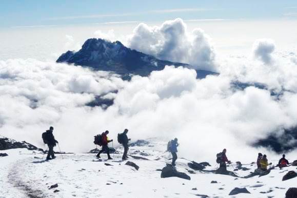
The Northern Circuit route is one of the best routes on Kilimanjaro, offering nearly 360 degrees of beautiful scenery including the quiet, rarely visited northern slopes. As the longest route on Kilimanjaro, the Northern Circuit also has the most acclimatization time and the highest summit success rate. Thus, the Northern Circuit route is highly recommended.
The route approaches Mount Kilimanjaro from the west, beginning with a long drive from Moshi to Londorossi Gate. From there, the first two days are spent trekking through the rainforest to Shira Ridge, before crossing the Shira Plateau. The route then heads north and circles clockwise from Moir Hut to Buffalo Camp to School Hut, before summiting from the east. Descend is made via the Mweka route.
Stepclimb Adventures offers the Northern Circuit as a nine day group climb or private climb. A 10 day variation that includes an overnight at Crater Camp is available as a private climb by special request.
9 DAY NORTHERN CIRCUIT ITINERARY Day 1 We depart Moshi for Londorossi Gate, which takes about 4 hours, where you will complete entry formalities. Then drive to the Lemosho trailhead. Upon arrival at trailhead, we begin hiking through undisturbed forest which winds to the first camp site. DAY 2 We continue on the trail leading out of the rain forest and into a savannah of tall grasses, heather and volcanic rock draped with lichen beards. As we ascend through the lush rolling hills and cross several streams, we reach the Shira Ridge before dropping gently down to Shira 1 Camp. Here we catch our first glimpse of Kibo across the plateau. DAY 3 Shira 1 Camp to Shira 2 Camp We explore the Shira Plateau. It is a gentle walk east on moorland meadows towards Shira 2 Camp. The heath zone displays abundant wildflowers and unique Senecio trees. DAY 4 Lava Tower to Moir Hut We continue to the east up a ridge and then head southeast towards the Lava Tower – a 300 ft tall volcanic rock formation. Then we divert from the main trail to Moir Hut, a little used site on the base of Lent Hills. A variety of walks are available on Lent Hills making this an excellent acclimatization opportunity. Shira Plateau is one of the highest plateaus on earth. DAY 5 We trek out of Moir Valley with a moderately steep climb, then hike to the summit of Lent Hills before returning to the main trail. The path crosses a rock field and gently undulates before reaching Buffalo Camp. This section of the trail offers great views across the plains that lie north of Kilimanjaro and stretch out to the Kenyan/Tanzanian border. DAY 6 Buffalo Camp to Third Cave As we head up Buffalo Ridge, the terrain becomes increasingly sparse. This route is rarely travelled and we will enjoy its mountain wilderness feel. We trek through remote valleys on to the northern slopes of Kilimanjaro until we arrive at Third Cave. DAY 7 We climb steadily up and over the “Saddle,” which sits between Kibo and Mawenzi. We continue on to our camp, School Hut. Once here we rest, enjoy an early dinner to prepare for the summit day. DAY 8 School Hut to Uhuru Peak Uhuru Peak to Mweka Camp Very early in the morning (around midnight), we begin our push to the summit. This is the most mentally and physically challenging portion of the trek. The wind and cold at this elevation and time of day can be extreme. We ascend in the darkness for several hours while taking frequent, but short, breaks. At Gilman’s point (18,600 ft), you will be rewarded with the most magnificent sunrise you are ever likely to see coming over Mawenzi Peak. Finally, we arrive at Uhuru Peak- the highest point on Mount Kilimanjaro and the continent of Africa. From the summit, we now make our descent continuing straight down to the Mweka Hut camp site, stopping at Barafu for lunch. The trail is very rocky and can be quite hard on the knees; trekking poles are helpful. Mweka Camp is situated in the upper forest and mist or rain can be expected in the late afternoon. Later in the evening, we enjoy our last dinner on the mountain and a well-earned sleep. DAY 9 On our last day, we continue the descent to Mweka Gate and collect the summit certificates. At lower elevations, it can be wet and muddy. From the gate, we continue another hour to Mweka Village. A vehicle will meet us at Mweka Village to drive us back to the hotel in Moshi. |
RONGAI ROUTES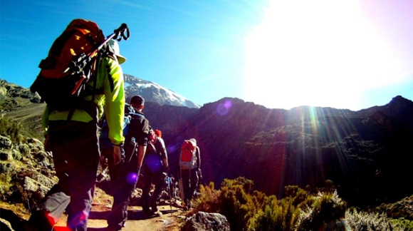
The Rongai route is the only route that approaches Kilimanjaro from the north, close to the Kenyan border. Though gaining popularity amongst climbers, this route still experiences low crowds. Rongai has a more gradual slope than the mountain’s other routes. It is the preferred route for those looking for an alternative to the popular Marangu route, for those who would like a more remote hike, and for those who are climbing during the rainy season (the north side receives less precipitation). Rongai is a moderately difficult route, and is highly recommended, especially for those with less backpacking experience.
Although the scenery is not as varied as the western routes, Rongai makes up for this by passing through true wilderness areas for nearly the entire way. Descent is made via the Marangu route.
Stepclimb Adventures offers Rongai as a seven day group climb or a six or seven private climb. The six day variation does not have an acclimatization day on day four at Mawenzi Tarn.
